Hints, Tips and Solutions – March 2005
Q. I have to send copies of my project layout to different members of my group, but they need to see only specific layers of the layout. How can I provide them only the required layers without having to alter my project?
A. You can use a stream out mapping file, which simply specifies the layers that are going to be output in the gds file. This procedure does not alter your design nor require you to create different copies of your design.
Here are the steps to export the GDS using a mapping file.
Open the ELD project and choose the cell from which you want to stream out.
Go to the Layer Bar and press on “NV” for non-visible, then make visible only the layers you want to be part of the streamed out file.
Go to the menu View>>Layer View>>Layer lists>> and choose “Save visible layer list”. This will open a window, which will allow you to save this visibility list in a mapping file (*.ell)
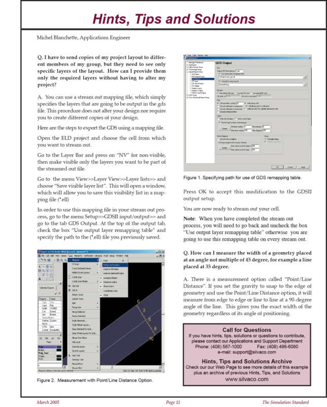
In order to use this mapping file in your stream out process, go to the menu Setup>>GDSII input/output>> and go to the tab GDS Output. At the top of the output tab, check the box “Use output layer remapping table” and specify the path to the (*.ell) file you previously saved.
Press OK to accept this modification to the GDSII output setup.
You are now ready to stream out your cell.
Note: When you have completed the stream out process, you will need to go back and uncheck the box “Use output layer remapping table” otherwise you are going to use this remapping table on every stream out.
Q. How can I measure the width of a geometry placed at an angle not multiple of 45 degree, for example a line placed at 35 degree.
A. There is a measurement option called “Point/Line Distance”. If you set the gravity to snap to the edge of geometry and use the Point/Line Distance option, it will measure from edge to edge or line to line at a 90-degree angle of the line. This gives you the exact width of the geometry regardless of its angle of positioning.


